Instead of a photography post, I want to bring you to a TEDx talk given by my wife, Melanie Snyder. I’m so very proud of her and her message!
Instead of a photography post, I want to bring you to a TEDx talk given by my wife, Melanie Snyder. I’m so very proud of her and her message!
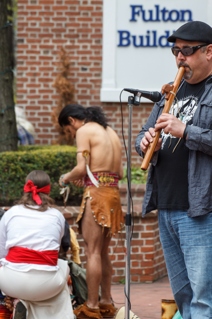
Numerous words come to mind when describing the scene in Lancaster City today. Weird, surreal, and eclectic should suffice. Because today — all within the space of a few hundred feet — I was able to observe a Native American protest and Lancaster’s annual Anime convention-goers.
Anime, to save you the effort of a Google search, is a form of Japanese animation that appeals to both children and adults alike. The result is an annual gathering of individuals who dress the part of their (presumably) favorite animated characters. The costumes give the downtown a decidedly Halloween feel here in April.
The Native Americans on the other hand were protesting a planned natural gas pipeline that will cut through Lancaster county, along with other grievances such as casino corporations fleecing Native Americans, and discrimination against people of Native American descent.
And you thought Lancaster was only Amish people and outlet malls . . .
The result, in photographic form:


I missed the peak of the snow geese migration this year, but did have a chance to visit Middle Creek Wildlife Management Area this past weekend. No snow geese photos, but here are few shots that I was able to capture.
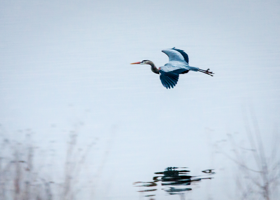
Can anyone identify this bird? I thought it was a blue heron, but a friend thinks it is not. (Low light / high ISO, so a bit of noise with this photo)

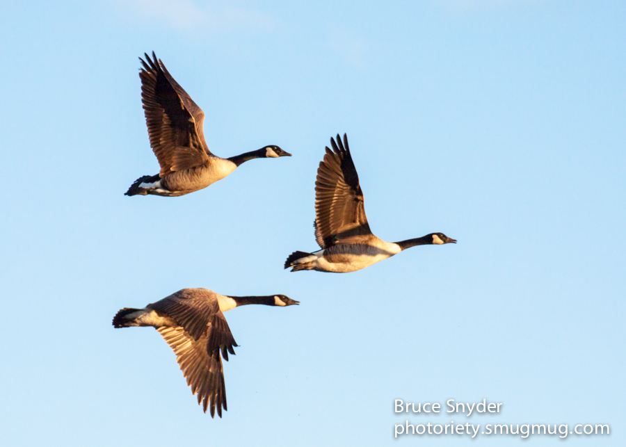
Canada goose

Same Canada goose, but processed with a bit more painterly effect.
The past year was a pretty good one photography-wise. It was aided immensely by two trips — a long weekend in New York City and a two-week trip to Utah. The Utah trip, planned months in advance, occurred during the first two weeks of October and was severely disrupted by the federal government shutdown. However, we were able to visit some spectacular areas not under federal management, and sneaked into quite a few national parks anyway. In short, neither the vacation nor the photography suffered too much. (But that is not forgiveness. We are governed by children.)
Following are my favorite photos of 2013. I hope you enjoy them. And as always, thanks for following my photo blog and for your kind comments throughout the year!

January: Canada Geese in flight; Middle Creek Wildlife Management Area (Pennsylvania)

February: Tundra Swans at takeoff; Middle Creek Wildlife Management Area (Pennsylvania)

February: Snow Geese in flight; Middle Creek Wildlife Management Area (Pennsylvania)

March: Grave, Unknown Soldier; Annapolis, Maryland

April: Sunrise over the Atlantic; Virginia Beach. No color saturation added.

April: Boardwalk and beach; Virginia Beach. Digital manipulation.

May: Street Musician, Central Market, Lancaster, PA.

July: Street scene: Washington Square Park, New York City.

July: Street scene; Washington Square Park, New York City.

July: Warehouse lights; New York City. Digital manipulation.

October: Melanie is not impressed. We hiked in anyway. (Not a great photo. Just a “What were you thinking, Congress?” photo.)

October: Aspens at forest edge; Grand Canyon National Park, AZ. Digital manipulation.

October: Eastern edge, Grand Canyon, as we hiked into the park from a national forest road, toward Point Imperial.

October: Point Imperial vista, Grand Canyon National Park, AZ; We were alone at this overlook thanks to the shutdown. A 5 mile hike round trip.

October: Milky Way on the horizon: at Coral Pink Sand Dunes State Park, Utah.

October: Milky Way rising; at Devils Den (near Escalante), Utah.

October: Monument Valley vista; Monument Valley Navajo Tribal Park, Utah / Arizona.

October: Dunes at sunrise; Coral Pink Sand Dunes State Park, Utah.

October: Slot canyon; near Escalante, Utah.

October: Slot canyon; near Escalante, Utah.

October: Melanie exploring a slot canyon; near Escalante, Utah.

October: Cisco (abandoned town); north of Moab, Utah.

October: Cisco (abandoned town); north of Moab, Utah.

October: Cisco (abandoned town); north of Moab, Utah.

October: Desert scene; near Corona Arch (Moab Area), Utah.

October: Natural window; near Corona Arch (Moab area), Utah.

October: Three Sisters at Sunrise; Arches National Park, Utah.

October: Panorama; Arches National Park, Utah.

October: Desert scene; Arches National Park, Utah.

Delicate Arch at Sunset; Arches National Park, Utah.
If you travel to the Desert Southwest and like to hike, at some point you will end up hiking to (and into) a slot canyon. On a previous trip Melanie and I went to highly regarded Antelope Canyon in Page, Arizona. And before that my good friend Rob and I did a strenuous hike in Paria Canyon on the Arizona / Utah border. This time on our most recent trip to Utah, Melanie and I sought out a couple of more remote and lesser known canyons.
A slot canyon is just what it sounds like — a narrow slot cleaved into the earth and rock. Not for the claustrophobic, but fascinating for anyone else who does not mind squeezing into narrow spaces. The photography is fantastic thanks to the red sandstone and muted light from above. Only one word of caution — check the weather forecast before you go. Thunderstorms and flash floods can be lethal in a slot canyon. With a little pre-planning and common sense, a slot canyon hike is likely to be something you will never forget.

(Above) The first slot canyon we found was as easy as can be. Fifty yards from the road and only a hundred yards or so in depth. This is a photo from the roadside showing the entrance.

(Above) You only need to walk 100 feet into a slot canyon to be in a different world. Outside sounds disappear but spoken word echos off the narrow walls. The temperature drops and your eyes slowly adjust from bright sunshine to eerie reflected light from the narrow slot above. The footsteps in the sand show that quite a few people have enjoyed the solitude we found here.

(Above) The second slot canyon was a lot more difficult. A 30+ mile drive on dirt road through the desert and a two-mile hike to the entrance. This photo is from near the trailhead. The slot canyon is out there somewhere.

(Above) Near the entrance after we traversed the two miles down to the canyon. This tumbleweed was too good for any photographer to pass up.

(Above) Melanie, just inside the entrance. Nice and wide and level to begin.

(Above) The slot quickly became more narrow and rocky. This slot was probably 800 yards or more in length.

(Above) Solid sandstone walls that have been sculpted by wind and water over thousands of years.

(Above) Melanie looking ahead at the narrowing slot. I married a true hiker — keeping up with her can be a challenge. Every once in a while I can get her to slow down for a photo. Having a person in the shot lends scale to the image. (Note the log high up on the wall, above Melanie’s head. It was likely deposited there during a summer flash flood.)

(Above) A bit of scrambling is required in some of the slots. The effort is worth it however, and we took this slot all the way to the end — with about a dozen stops along the way as I set up my tripod and took fifty or so photos.
Maybe I’ll have my ashes scattered in a slot canyon. They are seriously that cool!
— End —
In early October, our reservations canceled at shut down Zion National Park, we decided to instead camp and photograph the dunes at Coral Pink Sand Dunes State Park in Utah. As we were to discover, the state parks in Utah are fantastic and Coral Pink Sand Dunes is no exception. Although the dunes are open to ATV riding during the day, they are off-limits to the vehicles until 9 a.m. — more than enough time to photograph them at sunrise. And after all, sunrise (and sunset) is when you capture the beautiful colors and deep shadows that have made sand dunes attractive subjects to photographers since the invention of the medium. That Melanie and I were the only people up and stirring as the sun rose only made the experience better.
.
 (Above) This is actually a contrasty late afternoon photo taken shortly after we arrived. I like how the hikers provide scale to the image. As for hiking — well, I love hiking. But not in sand. In fact, it sucks. I’d rather take photos of other people hiking in sand.
.
 (Above) This is what the dunes look like at dawn, immediately after the sun rises over the nearby mountain.
.

(Above) Another sunrise “kiss” on one of the dunes, this one using a zoom lens.
.
 (Above) This is actually two separate photos stitched together using the panorama feature in Adobe Elements 10. I have some 5-image panoramas that would make fantastically big prints, but would be too long and skinny to display correctly on a website! The technique is pretty easy. Getting there before the sun is the harder part.
Twenty or thirty minutes later the light and colors were gone, replaced by Utah’s harsh sun and cloudless skies. Photos like this are available to anyone — providing that you can roll out of bed (or, in this case, sleeping bag) and get there before the sun!
.
Our trip to southern Utah coincided with a new moon phase. Having been out west before I knew that meant a beautiful night sky that we rarely, if ever, see on the east coast. It also meant that I had the opportunity to try some Milky Way photography — something that has been on my to-do list for a long time.
Preparations were fairly straightforward. I did some pre-planning by reading a few excellent celestial photography blogs, including David Kingham’s free online tutorials. I also had the good fortune of meeting and spending an evening photographing the Milky Way with Jon Fuller, a photographer who lives in Moab and has been published in National Geographic Magazine (among other publications). We collaborated with Jon and his wife, Paula, and both ended up with some fantastic shots in Devil’s Garden. Finally, I also downloaded a very cool free app called Night Sky 2 Lite to my iPhone. It allowed me to pinpoint where the Milky Way Galaxy would rise on the horizon, at 190 degrees south, between the constellations Scorpio and Sagittarius when we were there. (Note that the Milky Way rises at different times and at different places depending upon the time of the year and your location on earth. Early October was particularly convenient, as the galaxy rose shortly after sunset).
Although these are first attempts, below are four images that I particularly like, with my notes appended. The gas cloud that you see in the photos below is what gives each image a “wow” factor. Unlike the human eye, a camera gathers additive light for as long as you keep the shutter open. This allows you to see things that the naked eye does not.

(Above) Location: Kodachrome Basin State Park, Utah. Exposure: 30 seconds; ISO 3200; Processed in Adobe Lightroom 4.

(Above) Location: Kodachrome Basin State Park, Utah. Exposure: 30 seconds; ISO 3200; Foreground “painted” by Melanie Snyder with a flashlight; Processed in Adobe Lightroom 4.

(Above) Location: Devil’s Garden (near Escalante), Utah. Exposure: 30 seconds; ISO 3200; Foreground “painted” by Melanie Snyder with a flashlight; Processed in Adobe Lightroom 4.

(Above) Location: Devil’s Garden (near Escalante), Utah. Exposure: 30 seconds; ISO 3200; Foreground “painted” by Jon Fuller with a very large flashlight; Processed in Adobe Lightroom 4.
Melanie and I had planned our 30th wedding anniversary trip months ago — a trip to Utah / Arizona to visit five national parks and several national monuments and BLM areas over the first two weeks of October. Congress forced us to change our plans, and one of the pleasant surprises while adapting to the silliness of closing those areas was a photo session at a mostly abandoned town in Utah called Cisco. Most of the photos were taken with a fairly scary thunderstorm bearing down on us. Truth be told, this added an aura of spookiness that would not have been possible under typical Utah sunshine and blue skies.
Below is Melanie’s writeup about Cisco and several of my photos. The photos are heavily processed HDR images to accentuate the threatening clouds and dilapidated buildings.
In its heyday in the late 1800’s, Cisco was a “watering stop” for steam locomotives on the Denver and Rio Grande Western Railroad. It also became a livestock hub for cattle and sheep ranchers from the Book Cliffs, north of town. According to an online history of Cisco by Nancy Hazelet, at the turn of the last century, over 100,000 sheep were brought to Cisco for shearing before being shipped to market. Oil and natural gas were discovered in Cisco in 1924, and it became a drilling and mining center. But as steam locomotives began to be replaced by diesel and electric early in the 20thcentury, Cisco was no longer necessary as a watering stop, though the trains still ran through the town.
Cisco also used to sit right along US Route 50 and US Route 6, major east-west highways that ran from California to Colorado and beyond. But between 1957-1970, Interstate 70 was built along a new route that bypassed Cisco (along with many other small “hub” towns), and Cisco began to slide into oblivion, though it was assigned its own zipcode when the new postal zipcode system came into effect in the 1960’s. The faded paint on the façade of the town’s abandoned post office is only faintly readable “Cisco, Utah – 84515” A small freestanding unit of modern locked mailboxes stands right outside the post office building, and it looks like there must be a few people who still get mail sent here.
In the early 1990’s, parts of the film “Thelma and Louise” were filmed in and around Cisco.
Despite the desolation of the town itself, there are miles and miles of brand new pipeline being laid here. Cisco has one of the oldest oilfields in Utah. Pacific Energy and Mining Corporation, an oil and gas company headquartered in Reno, Nevada, operates the drilling fields here, including 5 oil and natural gas wells that the company started in 2005..

.
 .
.
 .
.
 .
.
 .
.
 .
.
 .
.
 .
.
 .
.

One hot summer morning, rich portraits of life in and around Washington Square Park in New York City.

.

.

.

.

.

.

.

.

.

.

.

.

.

.

.

.

*** END ***
Before this past weekend I had never heard of the High Line walk in New York city. And I really had no idea what to expect when we set off across mid-town toward the 30th Street access point. What a great photographic treat it turned out to be! The High Line is a public park built on an old elevated freight rail line, a funky and fun walk above the streets along the lower west side of Manhattan.
The elevated platform is approximately a mile long and put us at rooftop level with numerous warehouses and apartment buildings all the way down to the Meat Packing District. This allowed me to indulge in one of my favorite forms of photography — architectural details. Or as I prefer, “Urban Geometry”. Take me somewhere with bricks, graffiti, fire escapes, and a good dose of glass and I’ll find images worth photographing.
Here are some favorites from a 45-minute stroll on the High Line. Next time I think I’ll walk it from south to north to see what I missed!

.

.

.

.

.

.

.

.

.

.
.

.

.

.

.

.

.

.

.

.

*** END ***
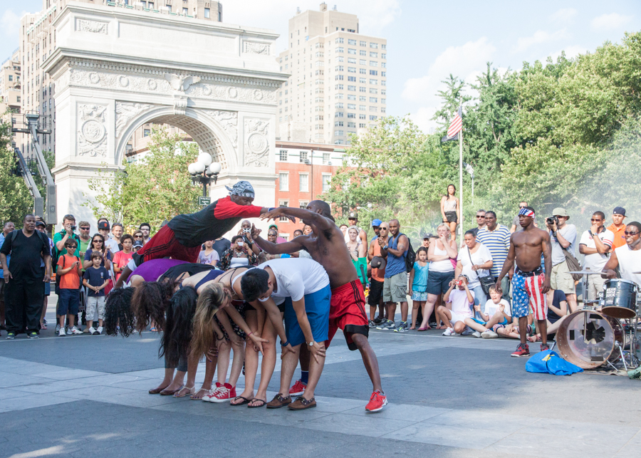
“Don’t f***in’ move. We’re not insured.” The last instruction directed at five audience “volunteers” by one of the Tic and Tac twins, street performers in Washington Square Park, New York.
These guys are funny (unless you’re way uptight and offended by racial jokes), talented, and really good at parting you from your money. “The average donation for a show like this is $20. If you can’t afford $20, $10 will do. If you can’t afford at least $5 . . . People, get a job and do something productive with yourself!” That said, the show was easily worth the $15 we threw into the bag. A bargain by New York City standards. Can you see that giant T-for-tourist tattoo on my forehead?
Oh yeah, these guys have their own website with an online merchandise store and a Facebook page. Not exactly your average weekend buskers.
Here are some images from the show:

(Above) The drums sucked me right in, just like they were intended to do.

(Above) A few dance moves to warm things up and draw in a bigger crowd.

(Above) A couple of tumbling runs. I set the camera at 800 ISO to freeze the action. Most of the photos ended up at 1/750th to 1/1000th sec. Plenty fast enough to freeze the action.

(Above) A no-hands head stand on concrete made me wince.

(Above) The split really made me wince. No chance, not even in my younger days. Ouch.

(Above) I couldn’t tell for sure but I think this guy did 3 full 360-degree one arm revolutions. Unfortunately I’m not talented enough to photograph and count at the same time.

(Above) Another tumbling run. In mid-air and eyes wide open. I love this shot.

(Above) And another mid-air shot. (Did I mention that these guys are really, really athletic?)

(Above) One twin spinning the other on his head. Tough head, solid abs.

(Above) Final instructions for the grand finale. The girl in the middle was a bit concerned. “You are about to see something you’ve never seen before — a black man running at full speed and not being chased by a cop! Don’t f***in’ move. We’re not insured!”


(Above) With a landing on a hard concrete surface to boot. Tough way to make a few bucks.
Wait, what? Brother Josephus and the Love Revolution? That was my question when I checked out the band list for the city’s “Celebrate Lancaster” event on Friday evening. The bottom line was that I had never heard of them, and I even wondered if maybe they were some local church gospel group or something. I was not hopeful. And in the end, I could not have been more wrong or more pleasantly surprised.
Brother Josephus and the Love Revolution hails from Brooklyn and they are a high-energy, twelve-piece explosion of rockin’ soul music. The energy on stage was palpable and connected with the audience like very few bands manage to do. Combine outstanding guitar, keyboard, lead and backup vocals, with a lively brass section and more energy than a three year-old on a sugar high and you have an awesome musical experience.
Kudos to Brother Josephus and to the Mayor’s Office of Special Events for a fantastic Friday night show. Here are a few photos that I hope hint at the fun and energy. I wish I had arrived earlier and captured more images of the band. But I’ve subscribed to their fan list, so maybe next time.


Thanks to the despicable invention miracle of Facebook, I have been noting the recent and inexorable parade of classmates’ birthdays. Like millions of others I type in the obligatory, “Happy Birthday, your name here!”. A somewhat heartfelt gesture and momentary delay of my second swig of coffee. Actually, birthday wishes are deeply ingrained in my morning routine of finding ways to avoid doing actual work. After all, if there are no birthdays on which to comment I must find another 5-second avoidance activity to fill the gap. Come to think of it, it practically ruins my day. This is why I never follow through on threats to drop Facebook. I’d have to do more actual work. (To all my friends and relatives to whom I have recently wished a Facebook happy birthday, it was a heartfelt gesture. No, really, seriously. Ah, hell.)
I digress. So as we stare down the barrel of our 56th such celebration I can’t help but wonder what life was like back then (or way WAY back then as my kids would say). This happens once a year, and I really have no control over it. I do Google image searches (I’m too ADD to read the content) and click on whatever catches my eye. This usually elicits a bevy of Holy shit! responses. This year I have the urge to share those Holy shit! findings. Sorry.

The world was, shall we say, a bit nuclear obsessed in 1957. The U.S. detonated multiple nuclear bombs in the Nevada desert and even brought in Marines for a little live-action training. Many of these blasts were within 65 miles of Las Vegas, which in that great American free-enterprise tradition created . . .

. . . Atomic Blast Weekends in Las Vegas! (Note mushroom cloud in background). Yes, you too could pay premium rates for a room facing the test grounds on a scheduled blast weekend! Radioactive fallout worries? Wimps. Go to the Jersey Shore if you can’t take a little radioactivity.

But wait! It gets better. America had a “Miss Atomic Bomb” in 1957! Her name was Lee Merlin, a Copa Room showgirl complete with cotton mushroom-cloud bathing suit. Hah! Take that Soviet Union! You may have conducted 4 atmospheric nuclear tests in April alone, but our Miss Atomic Bomb was surely better than any furry-hatted Kremlin babe.
On a side note and as a photographer, I really appreciate the camera angle and use of perspective in this photo. I mean, not only is “Miss Atomic Bomb” much more shapely and beautiful than anything the communists could conjure up, but she is apparently 300 feet tall and designed to strike fear into the hearts of every living Bolshevik. Take that, comrades!

Speaking of beautiful women (this is where I switch over to saying “beautiful women” instead of “babes”, lest my wife point out the error of my ways), just like today they were used to sell cars back in 1957. Except, you know, with more clothes on. A lot more clothes on. And pantyhose. And goofy poses. Come to think of it, what the hell?

On April 13th (Hi Denise!) the US Postal Service temporarily halted Saturday deliveries because of . . . wait for it . . . lack of funds! On April 15th Congress appropriated $41 million (hah! chump change) and Saturday delivery was restored. And who says history doesn’t repeat itself? In the words of Yogi Berra (who was still with the Yankees in 1957), “It’s deja vu all over again.”

In 1957 the schools in a place called Little Rock were desegregated. As we all know (or should know), President Eisenhower sent several thousand National Guard soldiers to Little Rock to assist the kind citizens of Arkansas in complying with federal law.

But in other news, Elvis decided to renovate Graceland and installed this metal music gate. Because, why not? When you’re Elvis, it’s what you do.

Speaking of music and 1957, these guys were in a band. It was called The Quarrymen. Anyone else think McCartney looks like Alfalfa from The Little Rascals?

And some guy named Ted Geisel published a book. One that thankfully was the beginning of the end of the excruciating “See Spot run” method of teaching reading.

But we were still a cranky nation because of things like this.

So we held parades in Washington D.C. to show that we had things that could fly, too.

And because we were really afraid of this . . .

. . . and of looking like this cheerful bunch . . .

. . . the House Un-American Activities Committee held the author of this play in contempt of Congress for not ratting out his friends. But he probably didn’t notice . . .

. . . because he was married to this woman at the time. I mean, God bless America! Amiright men?

But all’s well that ends well because we had a new toy called “The Pluto Platter”! Of course those heathens in 1958 ruined it by rebranding it as the “Frisbee”. But we 57’ers know the real name.
Happy Birthday, (your name here!) to everyone else born in that golden year of 1957! The good ol’ days? I’m not so sure. And Holy shit!, do I feel old . . .
Hula-Hoop Girl braved the cold wind this morning and did her thing in Penn Square, downtown Lancaster. This was my first sighting of HHG this year. It is not uncommon to see her set up pretty much anywhere in the city. Music, hula-hooping, awesome smile, and just pure pleasantness. As a by-stander said this morning, “Hula-Hoop Girl rocks!”
Good friend Joe Devoy tells me that Hula-Hoop Girl will be putting on her show at Tellus 360 in the near future. There is a whole lot more to Lancaster than outlet malls and all-you-can-eat restaurants along Route 30. Get yourself into the city on the first sunny and warm spring day. Hula-Hoop Girl and the street musicians make it a pleasure!


The migration is underway as thousands of snow geese are on the lake at Middle Creek Wildlife Management Area on the Lancaster -Lebanon border here in Pennsylvania. I stopped by yesterday for a few hours. The numbers of snow geese should continue to climb for at least a couple more weeks. The Tundra Swans are still on the lake too.

(Above) Location: Middle Creek Wildlife Management Area. Two snow geese do a fly-by over the lake. Beautiful, powerful-looking birds.

(Above) Location: Middle Creek Wildlife Management Area. The start of thousands of snow geese going aloft. They fly around above the lake and then settle back down after a minute or so. Sometimes it appears to happen for no reason. Other times it happens when a bald eagle or some other predator flies nearby. It’s an awesome and noisy sight to behold.

(Above) Location: Middle Creek Wildlife Management Area. Tundra Swans fly over the lake.

(Above) Location: Middle Creek Wildlife Management Area. Two Tundra Swans fly overhead.

(Above) Location: Middle Creek Wildlife Management Area. Snow Geese flying above the lake.

(Above) Middle Creek Wildlife Management Area. Back on the lake — some in the water, some standing on the ice.
Yesterday was a relatively mild Saturday with soft sunlight, thanks to some high wispy clouds. I decided to hop into the car for the forty-minute drive up to Middle Creek Wildlife Management Area. I had heard from other photographers that the Tundra Swans and a handful of Snow Geese had already arrived. Given the warm lighting conditions I hoped to capture a few shots of the beautiful Tundra Swans. A bonus was when four Canadian Geese flew close by, angled nicely toward the late afternoon sun. I was able to track them and capture four frames before they disappeared behind some trees. Common compared to the Tundra Swans, Canadian Geese are nonetheless beautiful birds, especially in flight.


Last year I complained about the year-end penchant for “best of” lists, and then promptly offered my own 2011 photo favorites. Without beating that dead horse again, here are my favorites from 2012. Some are (I believe) strong images. Others simply conjure up a strong memory — what I like to call “the backstory”. Thanks once again to all who followed my posts and commented on my photos this year. May you have the happiest and most blessed of holiday seasons!
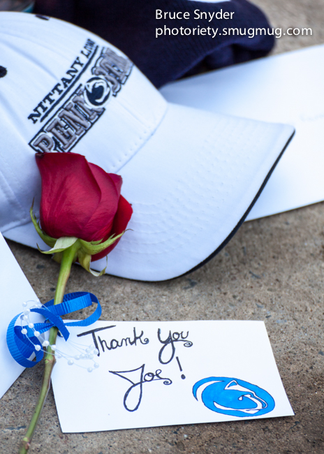
(Above) For those of us who are Penn State alumni and fans, the year started under a cloud of scandal and daily revelations — each seemingly worse than the last. The blue & white sky grew darker in January with the passing of Joe Paterno. I took a day off to go to the memorial service. The image above is just one of many captured that day.

(Above) Between mid-February and early March tens of thousands of waterfowl stop and rest at the Middle Creek Wildlife Refuge each year on their way back to Arctic nesting grounds. Disappointed in the Snow Geese photos captured one particular February morning, this image of Tundra Swans made the pre-dawn trip worthwhile.
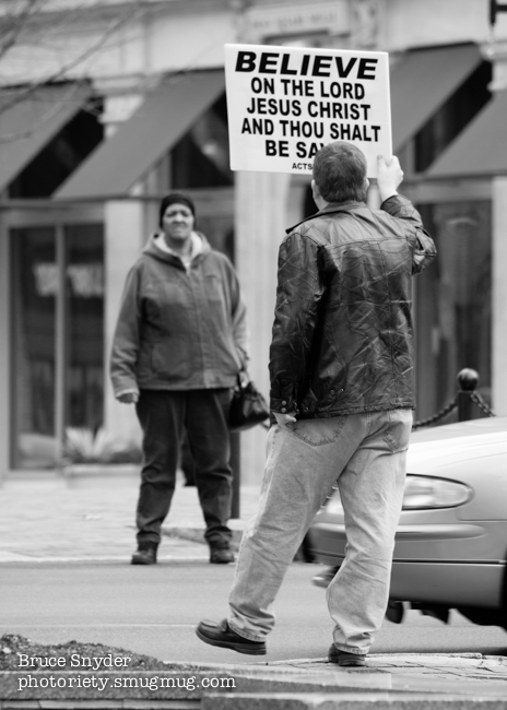
(Above) Every Friday between noon and 1 p.m. a street preacher loudly delivers his message from Penn Square in Lancaster City. Any form of communication needs both a sender and a receiver. Capturing both in a single shot made this image a keeper.

(Above) I love to photograph kids because they in turn love to have their pictures taken. This little girl was part of a large crowd at Central Market on an unusually warm March day. She was content to lick her lollipop and watch me take photos from about 30 feet away. She never flinched when I pointed the camera her way.

(Above) In April, Melanie asked me what I wanted to do on my birthday. I chose to visit Eastern State Penitentiary in Philadelphia. An exceptional place for photographers or anyone interested in historical sites, we spent an entire afternoon there while I easily took over 300 photos. I’m already anxious to go back next year. This is a view of a dilapidated wing of the prison. Each door represents a cell where a single inmate was housed. The solitary existence encouraged repentance of sinful ways, or so thought the Quaker-influenced administrators.

(Above) A peak into one of the solitary cells at Eastern State Penitentiary.

(Above) In May friends of ours asked me to volunteer my photography skills for a fundraiser to benefit Rafiki Africa. I spent much of the time photographing the 5K race and awards ceremony. In between official duties, however, I took advantage of the time to photograph these young dancers.

(Above) As I mentioned earlier, children tend to like to be photographed. This young man certainly did.
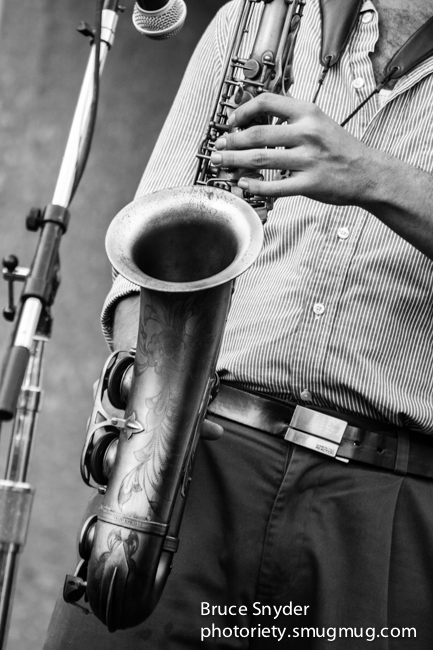
(Above) May was also a good month for the music scene in Lancaster. This image was captured on Music Friday. I spent a good deal of time on my computer bringing out the ornate detail on this saxophone. Melanie liked it well enough to have a gallery print made and it now hangs in our living room.
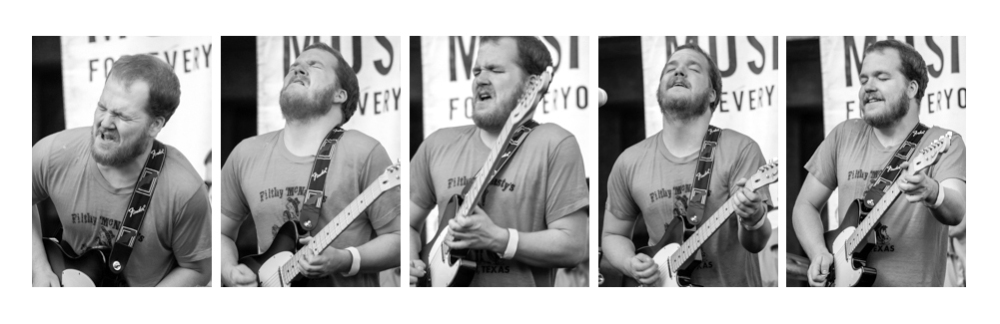
(Above) Earlier in the same evening of the saxophone photograph I was enjoying the guitar riffs by this guy. These are five sequential shots captured within a span of ten to fifteen seconds. I call it The Agony & The Ecstasy of a Lead Guitar Player.

(Above) For whatever reason, June and July were photographically barren months for me. I managed to grab some decent shots of daylilies outside of a local church.

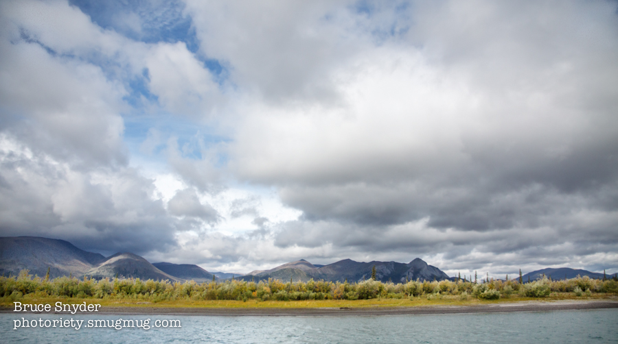
(Above) I broke out of the summer photography drought to the tune of 1,655 photos in August, thanks almost entirely to a twenty-day trip to Alaska. This was a learning trip through a wonderful non-profit organization called New Community Project. It was a no-frills and physically demanding trip. (I loved it). The trip started out touring Kenai Fjords National Park via boat. The Alaskan coastline is spectacular.

(Above) And the sea life was equally spectacular, as well as a bit noisy.

(Above) The second leg of our trip to Denali National Park turned out to be equally beautiful. We got out and hiked a lot. My recommendation? Get off the tour buses and off the deck chairs and get close to the land. You’ll never regret it . . . as long as you stay far away from the grizzlies.
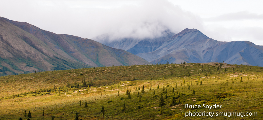
(Above) Another mountain shot from Denali National Park. I love when there are small breaks in the clouds that provide spotlighting like this.

(Above) Vistas in Denali are awe-inspiring, but there is beauty underfoot too. These grasses covered with early morning dew were too good for any photographer to pass up.

(Above) But the real reason most people travel to Denali is for the wildlife, whether it be ground squirrels near a river bed . . .

(Above) . . .or Dall Sheep on a mountain top. I love this photo as a stand alone image, but it is even more meaningful to me considering that we hiked about four miles (much of it uphill) to get to this location.

(Above) The third leg of our trip — and by far the most unusual and rewarding — was to a native Alaskan village above the Arctic Circle, called Arctic Village. The people who live there and who hosted us are called the Gwich’in. They live in the single most remote location in the western hemisphere, a 300 mile flight from Fairbanks, with the nearest road 150 miles away. The land is ruggedly beautiful; the weather ranges from comfortable in the summer to brutal in the winter. Our hosts were Charlie and Marion Swaney. This is the view from their front porch in August.
(Above) And this is the view from the banks of the nearby Chandalar River. The land you see across the river is the Arctic National Wildlife Refuge.

(Above) This is Charlie Swaney, our host. An outdoorsman supreme, advocate for the Gwich’in way of life, and all around great guy. Charlie welcomed us into his home (or in Melanie’s and my case gave us a nice piece of tundra to pitch our tent on) and he taught us more than I ever thought I’d know about the caribou herds on which his people depend.

(Above) This is Marion Swaney. Charlie’s wife, camp boss, and our host too. She has lived in Arctic Village her entire life, along with approximately 140 other Gwich’in.

(Above) This is Charlie’s grandson, Little Charlie. He only stopped by for a few minutes, but once again showed a child’s interest in my camera.

(Above) And this is Derek, Charlie and Marion’s nieces child. Derek was a constant at the Swaney home and came along with us to the hunting camp. He was my little buddy for much of our stay there, and I somehow found myself giving him lots of piggy-back rides whenever we hiked uphill. Derek was a big part of the reason that I lost 8 pounds in twenty days despite eating a high calorie diet!

(Above) Speaking of hunting camp . . . this was the view when we got there.

(Above) And this was the view when the sun was setting around midnight. Those mountains are part of the Brooks Range in the Wildlife Refuge.

(Above) One of the highlights of our arctic trip was when we did a fairly long, arduous hike into ANWR and up the side of a mountain. Here you see Melanie taking in the view with her camera. The day was also a highlight for Charlie because he spotted a small group of 25 or so caribou on a neighboring ridge — the first caribou sighting of the season. Caribou mean sustenance to Charlie’s people.

(Above) The arctic is a land of water, spruce, mountains, and vastness. It is not a place for novices to walk around without a guide. We were all happy to stay with Charlie, even if keeping his pace was exhausting.

(Above) One of the surprises in Arctic Village was meeting this young lady, a college intern from New York named Madeleine. She was an assistant to Sarah James, an activist village elder. This photo was taken inside a historical Episcopal Church on a chilly August day.

(Above) By September we had returned to the lower 48 and I was wandering around Lancaster City once again. Turning the corner onto Prince Street I spotted this meditating woman near the upscale Prince Street Cafe. The juxtaposition between the meditator and the khaki-and-blazer cafe patron (who I believe is actually one of our county’s commissioners) was too good to pass up.
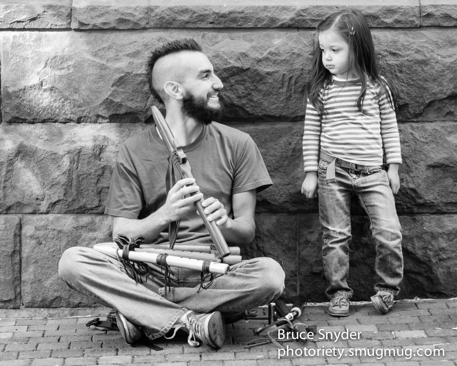
(Above) On that same day I was sitting and listening to this man play his native flutes outside of Central Market. When this young girl and her family (out of view) stopped to listen too, the image was obvious. Sometimes you just sit there and the photos come to you.

(Above) Later in September — at another Music Friday event — I ran across this young woman named Ali Taylor. She has a big time voice and a fledgling music career. You can hear a song or two here.

(Above) The same evening I photographed Ali, this band was playing on the main stage. I never saw “the eye” inside the trumpet until I downloaded the photos later. Serendipity.
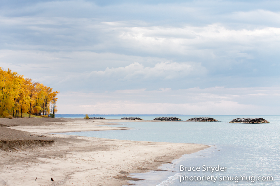
(Above) In October we drove across Pennsylvania to Erie to visit a friend. We took a few extra hours to visit a state park and see the great lake. The cloudy conditions actually made the foliage “pop” in this photo.

(Above) And of course Melanie had scoped out all the lighthouses on the shores of Lake Erie. So here is a nod to my wife and her love of lighthouses.
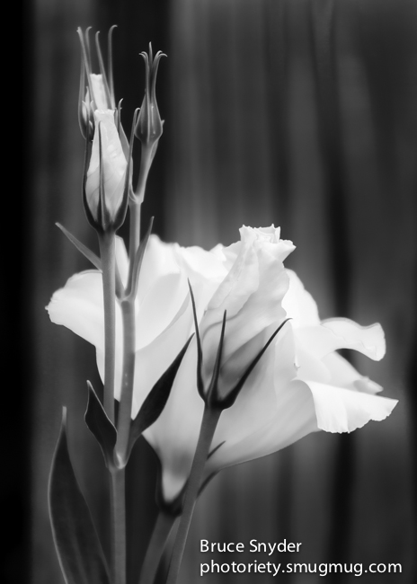
(Above) The last “keeper” of the year came at the end of October, in our own backyard. Although the color version is nice too, I find that the form of the flower and the background fence boards work better in black and white.
So there you have it, three dozen of my favorites from 2012. I hope you have enjoyed them too. Thanks for looking! Peace out.
As my friend Rob reminded me, I haven’t posted anything here for a while. I’ve been doing a lot of photography work — and even had a couple of my photos selected for a 2013 regional calendar — but there’s no doubt I’ve neglected Photoriety. So if hurricane Sandy doesn’t bring the power down (it’s raining sort of sideways at the moment) I’ll pick up on one of the highlights of our trip to Arctic Village, namely our visit to the Gwich’in summer hunting camp.
Hunting camp was a 4 to 5 mile hike “up mountain” to a plateau overlooking the valley where the Chandalar river separates Gwich’in land from the Arctic National Wildlife Refuge, and a couple of miles below the peak of the mountain on which we camped. It is a breathtaking view as well as a breath-taking climb, and our visit to hunting camp was one of the primary reasons that I lost 8 pounds in twenty days. That I shed those pounds despite eating half a dozen of Marion’s stolen-recipe biscuits is testament to the level of exertion. Four of us did twenty miles in a twenty-four hour period. If that sounds self-congratulatory, well . . . I guess it is. I don’t think I can ever thank David Radcliff enough for challenging me both physically and mentally on this trip. I’ve shed a total of 30 pounds in the last ten months, and if I ever start to put them back on I’ll just go on another New Community Project trip. As David says, “No charge for the weight-loss program.”
So here are photos from our treks to and around hunting camp.

(Above) Several of our group head up mountain. The Gwich’in hauled food and gear up to camp on ATVs for us, although Melanie and I decided to carry our gear up on our backs (part of the challenge). Gotta say, my wife is quite a trooper.

(Above) We didn’t leave for camp until evening and arrived after 9:00 p.m., although there was still plenty of light left in the day. The colors and scenery were exceptional, but I had to wait several minutes for my heart rate to come down before I could take this photo. It was markedly cooler up here than down at the village. That point was driven home the next morning when I stripped down to my skivvies and washed up in a nearby stream. Now that was breath-taking!

(Above) The log pole structure served as our kitchen area. The plastic sheeting is used to enclose the structure and smoke / cure caribou meat during hunting season. Thin strips of meat are suspended on the poles while a small fire burns below. This sheeting was no longer usable, so before we left we tore it down and took it back to the village for disposal. Ground squirrels in particular will sometimes attempt to eat the plastic, with fatal results.

(Above) The only other “permanent” structure was this canvass sidewall tent where our Gwich’in hosts Marion, Marie, Derek, and Deena slept. Here Melanie stands near the tent for a little shelter from the cold wind.

(Above) Melanie photographs out toward ANWR while we wait for the food and kitchen supplies to arrive. It was approaching 10 p.m., we had hiked 4 to 5 miles up mountain, and hadn’t had dinner yet. Photography was a good distraction from hunger!

(Above) Nay Quoy accompanied us up to camp and slept about 100 feet uphill from the main structure. His job? Keep an eye out for any approaching bear. Two years earlier, Marion had shot and killed a grizzly that was circling camp and acting aggressive. Nay Quoy was quite at home sleeping out doors. He made a nice little “nest” in the tundra grass, curled up, and covered his snout with his long bushy tail. I suspect that sleeping in 30 degree temperatures is a piece of cake for the dogs in Arctic Village.

(Above) After dinner we were treated to a midnight sunset. These mountains are part of the Brooks Range in the Arctic National Wildlife Refuge. Melanie and I were exhausted, but would not have missed this show for anything . . .

(Above) The next morning Derek was up and ready to go. He followed me down to the stream when I fetched water, which provided me with the opportunity to carry both the water and Derek back up the hill. It was just the beginning of a rigorous day.

(Above) Marion Swaney got a fire going in the morning and made a pot of “cowboy coffee” — pot, water, grounds. Filters? We don’t need no stinkin’ filters! The coffee was delicious and, thankfully, hot. Spit out the grounds or chew on them — your choice.

(Above) We took two hikes that day — a four mile round trip hike to the top of the ridge and back in the morning, and then a 12 mile round trip hike to another mountain overlooking Old John Lake in the afternoon / evening. The morning hike provided us with this view of Arctic Village and the Brooks Range mountains in the distance.

(Above) No grizzlies, only ground squirrels on our morning hike.

(Above) On the afternoon / evening hike, Jim, David, Judith, and I were treated to more spectacular high-elevation scenery. We were well above tree line for most of this hike, and we were glad for the cooler temperatures considering all the climbing we were doing.

(Above) David (holding camera), Jim, and Judith on the peak overlooking Old John Lake. It was a spectacular 360-degree vista. We ate some power bars and trail mix and got ready for the six miles (mostly downhill) back.

(Above) Jim – carrying the rifle — follows David and Judith on the trail back toward hunting camp. After 16 miles in one day, I’m sure my friends all slept as well as I did that night!
I have put together a book of selected black & white images from the past 25 years. You can see an online version here. There is a “View Fullscreen” option in the lower right hand corner that makes it easier to view.
I hope you enjoy the preview!

I’ve put off writing this blog post for a couple of weeks. I don’t really know how write it — as a photographer I’m much more comfortable with images than with words. It’s a subject that I feel strongly about, but those feelings don’t translate easily into cogent paragraphs.
So let’s just start off with a little simple history and fact setting. I’ll ramp it up from there.
The Gwich’in people who we visited on our August trip above the Arctic Circle are indigenous to Northern Alaska and the western Yukon Territory in Canada. There are somewhere between 8000 and 9000 Gwich’in spread throughout 15 different villages, with approximately 140 to 150 in the village we visited (Arctic Village). Most books and websites will simply refer to their existence for “more than 10,000 years” and attribute their being there to the land bridge that is thought to have once connected Asia and North America. The elders that we spoke with simply say “we have always been here”. What is not in dispute is that these people have lived and thrived in one of the world’s harshest environments dating back into pre-history.
The Gwich’in are one of the world’s last remaining subsistence cultures. They live off the land. In particular, they live off the caribou herds that migrate throughout the Arctic region, and as a result are often referred to as “the Caribou people”. A typical Gwich’in eats in the vicinity of 250 caribou-based meals each year. In our short stay we had caribou steaks and caribou stew, prepared by our hosts. Virtually every inch of the caribou is eaten or utilized in some way. These are not wasteful people.
To continue to survive as a subsistence culture the Gwich’in obviously need a healthy, thriving caribou herd. That, unfortunately, puts them smack in the middle of the debate about drilling in a section of the Arctic National Wildlife Refuge called Area 1002. There are hundreds of articles (and, ugh, biased emails) written about 1002. There is no way I can cover the entire debate here, nor do I want to try. But the gist of the Gwich’in dilemma is this: 1002 is smack in the middle of the calving grounds of the caribou herd that the Gwich’in depend upon for their very way of life. So when oil interests tell you that “It is only 2000 acres out of 19 million refuge acres”, remember that it is not just any 2000 acres. It is the source of regeneration for the herd upon which thousands of people depend. That’s an important consideration. It’s also irresponsible to hold a discussion about drilling in the Arctic without putting that issue front and center.
We know — let me repeat, we know — that caribou will leave an area where humans are present. They’ve been hunted by humans for thousands of years. They’ve learned and adapted. To think that caribou are oblivious to human presence is beyond illogical. Simply put, when people are present, caribou leave. It’s how they survive. Big Oil argues otherwise, but think about it — does that really pass the common sense test? And the bottom line is, if the caribou leave the traditional birthing grounds in Area 1002 it is likely that the herd will be irreparably harmed by both lower birth rates and / or higher predation. In either case, the size of the herd will decrease and the Gwich’in subsistence lifestyle will be harmed, and even possibly eradicated. That’s not a caribou issue — it’s a human rights issue.
So at what price are we willing to sacrifice an entire culture? Is this that bullshit “manifest destiny” concept redux — the one we were taught in grade school as a rationalization for penning lower-48 Native Americans onto reservation lands? Well, the non-partisan Congressional Budget Office recently released a study that did not support Big Oil’s ongoing narrative. The CBOs conclusion was eye-opening: Drilling in ANWR will provide America’s oil needs for a total of six months . . . beginning ten years from now . . . with a resulting price decrease of one to four cents per gallon.
So here’s the $64 million dollar question: Are you willing to sacrifice the livelihood of thousands of indigenous people for a 6-month price decrease of 4 cents per gallon, beginning somewhere around 2020? If you are, feel free to “unfriend” me and stop following my blog. If you aren’t, I urge you to contact your Representative and Senator. Tell them that 4 cents per gallon isn’t worth the price that will surely be paid by the Gwich’in people.
David Radcliff, our learning tour leader, told us of something a friend of his once said: “You won’t care about a river that you don’t know.” To paraphrase that saying, you won’t care about people who you don’t know. So here are some people who I really would like you to know and care about:

(Above) This is little Charlie. He lives in Arctic Village, Alaska. His grandfather hunts caribou for the village. (And yes, I’m playing the cute kid card. Hey, it’s my blog.)

(Above) This is little Charlie’s grandfather, Charlie Swaney. Charlie is my friend, and an ardent advocate for the Gwich’in way of life.

(Above) This is Charlie Swaney, doing what he always seems to be doing: watching for caribou.

(Above) This is Marion Swaney, Charlie’s wife. Marion once shot a grizzly bear that threatened the group up at hunting camp. Don’t mess with Marion.

(Above) This is Sarah James. Don’t let the smile fool you. Sarah was one of the Native Americans who occupied Alcatraz prison in San Francisco during the 70’s. She has also led protests in Washington, D.C. Sarah is politically savvy and smarter than any ten of us put together.

(Above) This is Gideon James, Sarah’s brother. Gideon, like Sarah, is an advocate for his people. But Gideon also served the United States as a soldier in the Armed Forces. His division was on alert and ready to be deployed during the Cuban Missile Crisis.

(Above) This is Fannie Gemmil. Like Sarah and Gideon, she is a Gwich’in elder. Fannie was also a TWA airline attendant (“stewardess”, back in the day). She missed the way of life in Arctic Village and moved back there from California. Fannie is very involved in her grandchildren’s lives.

(Above) This is Derek. He lives in Charlie and Marion’s home. In Arctic Village, the broader community looks after one another. Derek tagged along with several of us visitors much of the week. I will always remember the nap that he and I took on the tundra grass one afternoon up at hunting camp. And yes, I just played another “cute kid” card. IT’S MY BLOG!!!
